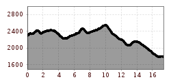
Description
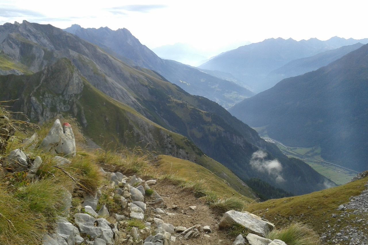
trail description: Make your way from Kaiserjochhaus Lodge on a singletrack trail that heads westward to climb a grass-grown peak; many sections are assisted by a fixed anchoring system of cables. Proceed ahead into a basin with lush green meadows. From there, the trail traverses tussock slopes and climbs up to the saddle between Schindlekopf Mountain and Bergleskopf Mountain. Descend from the saddle in another green basin and continue westward through a world of wide open meadows and pastures, named “Geißwasen”. At the end of Geißwasen, walk across a hilltop and descend to Leutkircher Hut, situated at the eastern edge of wide open and rugged Almajur Col (elev. 2,251m). Up to this point, the track is very loamy.
From Leutkircher Hut, walk westward towards Bacheregg, gaining Almajurjoch Col on a singletrack trail. This is where the Upper and Lower High Trails branch off. The Eagle Walk follows the easier Lower High Trail to the east, taking you through steep and rugged terrain to Kapallkopf Peak with adequate cable support in places. There is a gully beyond Bacheregg that can retain snow until late in the season. Eventually, the trail switchbacks upward to the Upper High Trail, gaining 50 vertical metres before heading westward across Matun Basin, from where it resumes climbing to gain Matunjoch Col and Valfagehrjoch Col. Beyond the latter, the trail drops down to Ulmer Hut, full of potholes and dolines. Look to the west to the Swiss border to bask in the glorious views of the Rätikon Range’s peaks, Zimba, Schesaplana, Drusenfluh, Sulzfluh… Ulmer Hut provides a perfect rest stop for hikers. Once replete and replenished, bear left and walk down verdant Alpine pastures towards Galzig Mountain, crossing the Arlberg Ski Resort to reach the reservoir. The trail passes above the top terminal of Schindlergratbahn Chair Lift and joins the Panorama Trail, that takes you up to the top terminal past Galzig broadcasting station. From the top, follow Maienweg Trail across dwarf pine fields and pass Maiensee Lake to your right; cross the dirt road at the right side of the bridge and take the footpath to St. Christoph Alm. From that point, a forest road winds down to Arlberg Pass Road, which you cross to get to the Arlberg Hospice Hotel in St. Christoph, the destination end of the Eagle Walk.
Don't forget: Sign the Adlerweg tour book at Gasthof Valluga and record your adventure for eternity!